The four case studies areas are:
– Portugal: Tagus River and Tagus estuary including Loures Municipality.
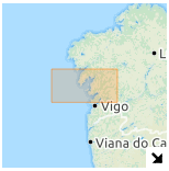
– Spain: Basin of Ulla-Sar Rivers and their estuary as well as the middle and outer part of Ría of Arousa.
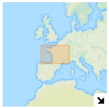
– France: Loire River and its estuary.
– UK: Severn River and its estuary.
The four pilot areas have strong socio-economic relevance, with several water-based activities (fishing, tourism, ports, etc.). They represent typical transitional urban zones in Europe with important rivers and transitional waters being associated with flood risks and potential hazmat incidents, due to the presence of industries – including nuclear power plants.
These areas will be studied at different scales depending on the type of incident to be handled:
- High resolution model scale will allow detailed study of different types of flood events (coastal, river or urban flooding) putting a special focus on urban areas that could be affected.
- Oil and chemical spills will be studied using mid-resolution models, since these types of incidents mostly occur at river and estuary scales.
- Lowest resolution models will be used for the assessment of nuclear contamination covering large areas. This scale is only considered in the cases of France and Portugal (involving the nuclear power plants installed in Chinon and Almaraz respectively).
Maps included in this section represent the areas studied in each country at different scales depending on the resolution level employed: flooding, oil/chemical pollution and nuclear pollution.


